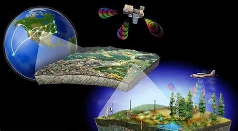
Remote Sensing and GIS
Remote Sensing and Geographic Information Systems (GIS) are powerful tools for observing, analyzing, and understanding spatial and temporal patterns on the Earth’s surface. Our content and research focus on developing and applying these technologies to address global challenges related to the environment, urbanization, natural resources, and disaster management.
By integrating satellite imagery, aerial data, spatial analysis, and geoinformatics, we provide actionable insights for science, policy, and industry.
Core Content Areas
- Remote Sensing Technologies
Exploration of multispectral, hyperspectral, radar, and thermal sensors for monitoring land, ocean, and atmosphere. - GIS and Spatial Analysis
Use of GIS platforms to capture, manage, analyze, and visualize spatial data for decision-making in diverse fields. - Image Processing and Classification
Application of advanced techniques for land cover mapping, change detection, and object recognition. - Environmental Monitoring
Tracking deforestation, land degradation, water quality, and ecosystem dynamics using time-series satellite data. - Urban and Regional Planning
Using geospatial tools for smart city planning, infrastructure management, and urban growth modeling. - Disaster Risk and Emergency Management
Real-time mapping and predictive modeling to support disaster preparedness, response, and recovery efforts. - Natural Resource Management
Spatial analysis for agriculture, forestry, mineral exploration, and sustainable land use planning.Our Remote Sensing and GIS research bridges science and society, offering innovative tools to better understand our world and shape sustainable futures. Through interdisciplinary collaboration and technology-driven insights, we empower decision-makers, researchers, and communities alike.